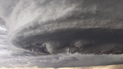
A severe weather threat continues from Minnesota to Texas on Sunday, a day after more than two-dozen tornadoes were reported in the heart of "Tornado Alley." The storms are associated with a potent area of low pressure that is tracking across the Plains, bringing rain and eventually even snow to North Dakota.
Meanwhile, along a cold front stretching from Minnesota to the U.S. border with Mexico, cold, dry air is colliding with warm, moist air streaming northward from the Gulf of Mexico. Differences in wind speed and direction with height, a phenomenon known as wind shear, is leading to the potential for a few tornadoes on Sunday. On Saturday, a long track tornado that was estimated at about a mile-wide at times, churned from near Elmer, Oklahoma, to near Tipton. The tornado crossed the Red River at one point, but miraculously only caused sporadic damage. Had it hit a town directly it could have caused a disaster.
Tornadoes were reported in Minnesota, Texas, Missouri, Kansas, Nebraska, Wyoming, Iowa and even Louisiana on Saturday, though these have not yet been verified by the National Weather Service. On Friday, tornadoes touched down in Colorado, and a hailstorm disabled the National Weather Service's Doppler radar tower outside Denver. They look so beautiful yet scary and destructive God help Us.

Comments
Post a Comment